Briefing
Overview:
The impact of Zonda on people and infrastructure and the peril to aviation makes it necessary to have a good forecast and give enough warning.
Here is the scenery:
|
|
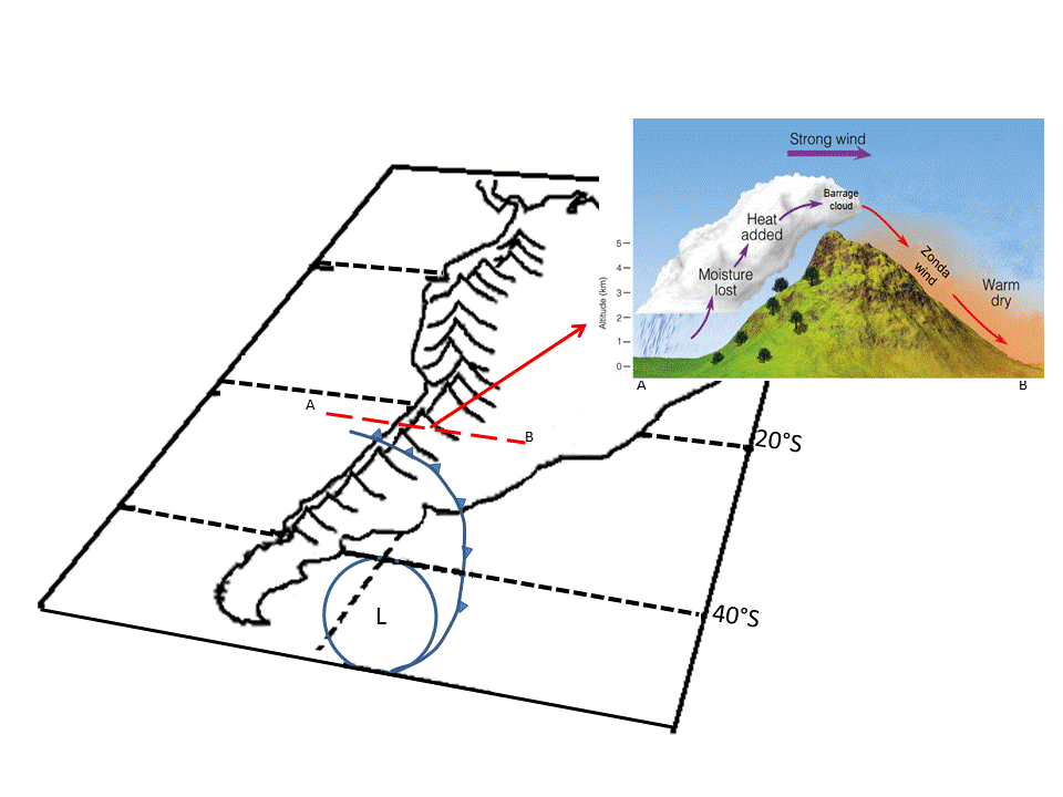
Where?
|
What happens?
|
|
|
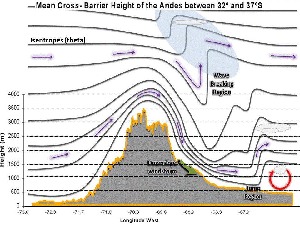
| Induced mountain waves – downslope wind storms – turbulence on the leeside of the mountain range
|
Outcome:
As a result of this activity the forecaster will be able to choose the suitable information to carry out the best possible analysis that leads to a good forecast and proper communication.
Begin by clicking INSTRUCTIONS to get familiar with the SIM and then enter the Modules.
Activity
There are 4 modules, each one is related to the local conceptual model as presented in https://sites.google.com/site/cmsforsh/CoE-Argentina/zonda-puelche based on satellite images and model data, and surface observations. The questionaire for each module can be used as a guide.
Bear in mind that these activities are content oriented so although the time– lapse is fast, you can take as long as you wish in analysing the event.
Module 1. Cloud Structure in Satellite Images.
Module 2. NWP Key Parameters: Equivalent Potential Temperature at 850, Wind velocity at 500hpa, Geopotential Height at 1000 and 500hpa, Stability.
Module 3. Vertical Cross Sections: Divergence, Vertical Velocity, Potential Temperature, Zonal Wind, Relative humidity.
Module 4. Weather events: Precipitation, Temperature, Wind, Humidity, Cloud.
Debriefing
Finally the discussion. Use the Forum to share your results and clear out any doubts, you may consider data limitations, uncertainties or clear signs of Zonda.
Back